


Climbing the Ladder of Kotor
Incredible landscapes and written observations from Montenegro

The past few years of my work have largely and actively been dedicated to street photography. This can be easily seen by the volume of that genre in my Instagram feed or my portfolio. And that makes sense because street photography was what originally brought me back to this craft after years of creative hiatus.
It has only become intentional in the last year to invest specific efforts into landscapes and more observational work that involves more of the natural world. My wish is to be an adept observer whose skills are not just limited to the city. So I have decided to trade some local sidewalks for hiking trails farther afield.
My planning and budget for this year yielded two destinations from which I have derived incredible experiences; both photographic and personal. Vancouver Island was the first I shared, and now, I’ll show you Kotor.
The Ladder of Kotor
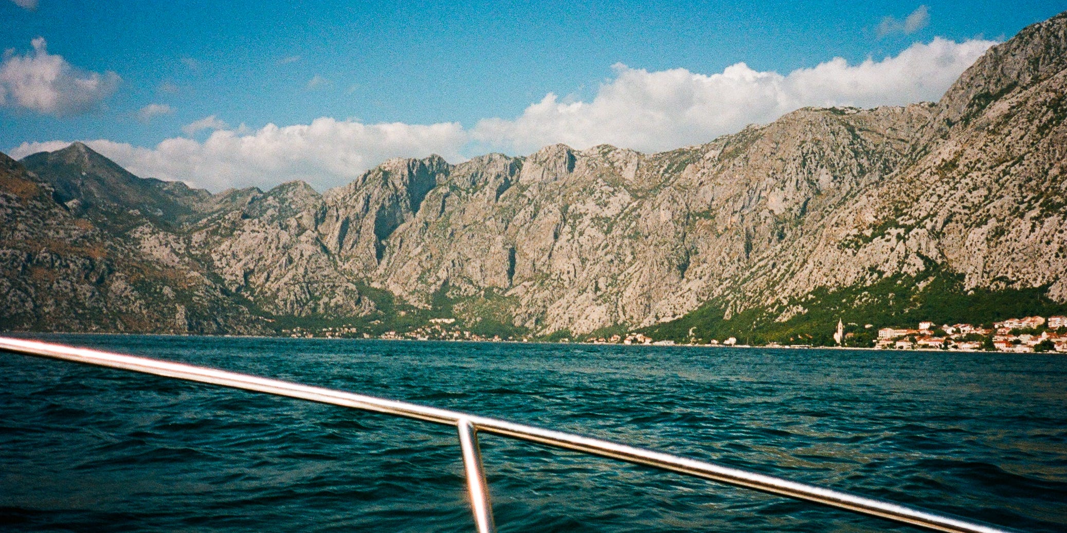
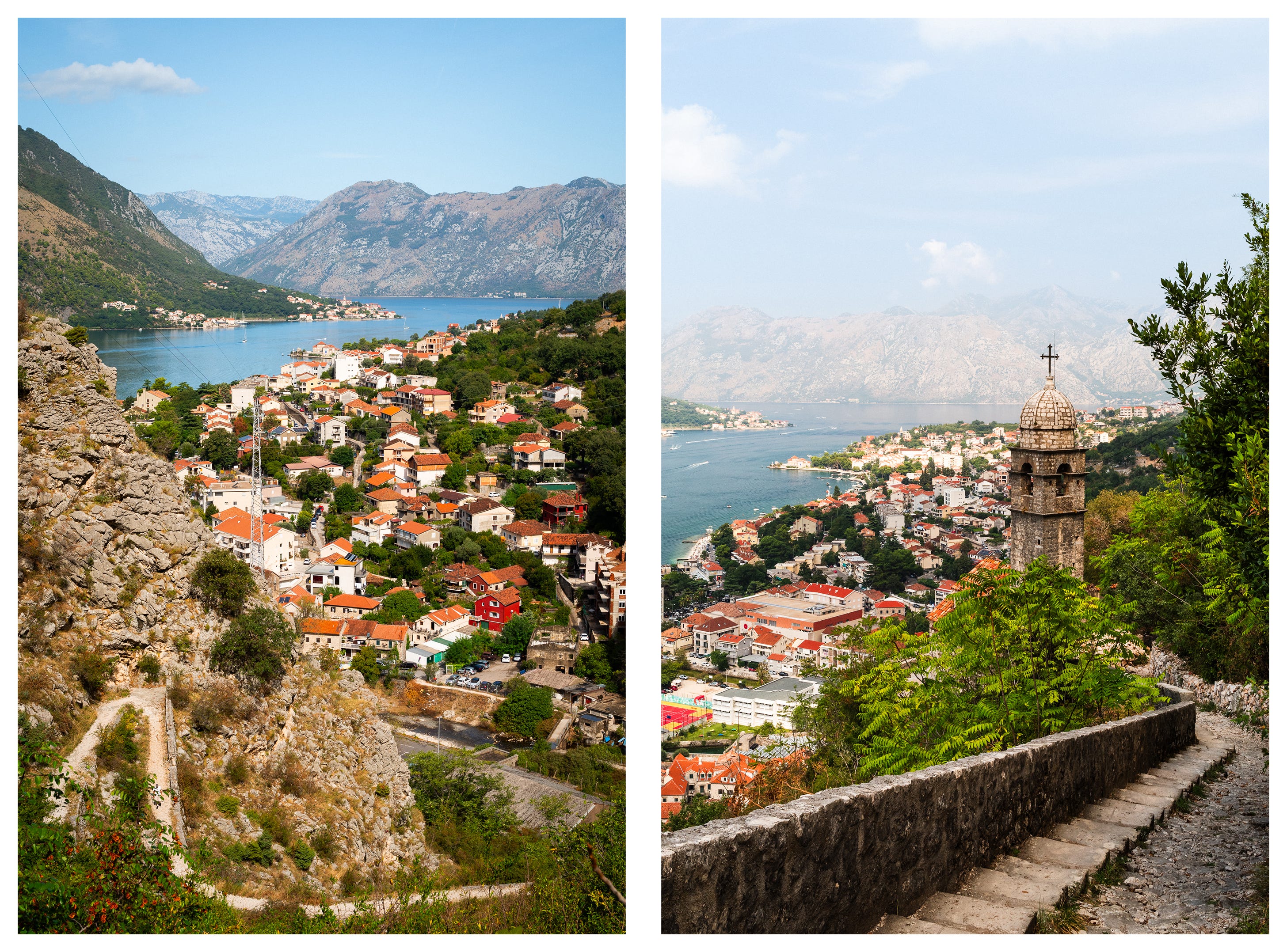
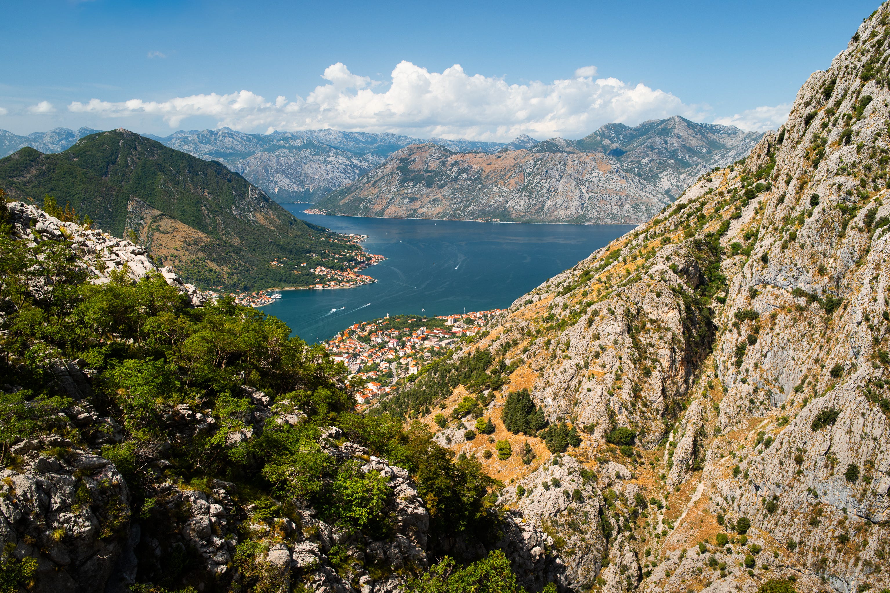
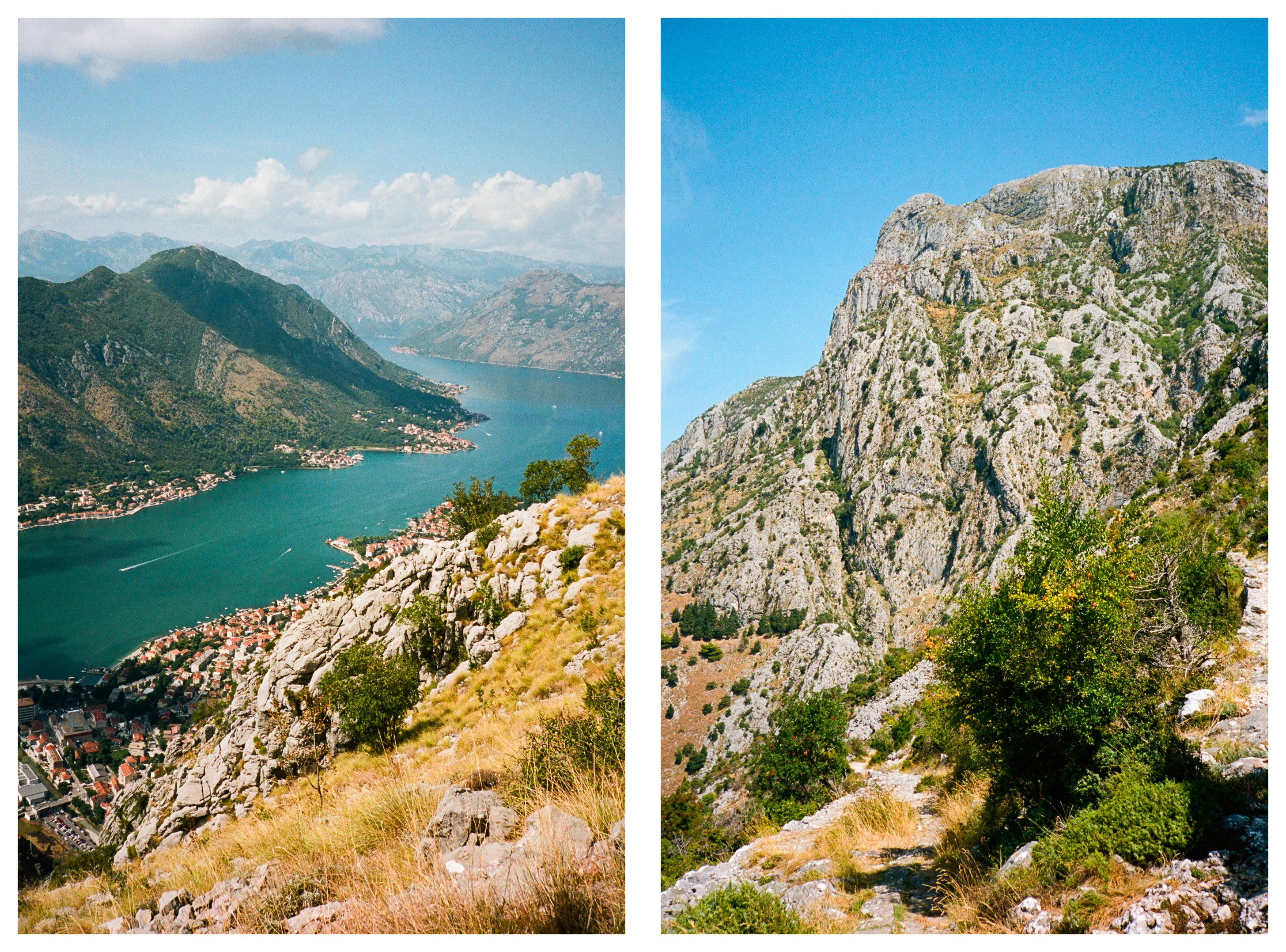
There is a hike that follows an old Austro-Hungarian trail up the mountain over the town of Kotor and its namesake bay. From sea level up to 950 meters, attempting this hike and reaching the viewpoints along the way was to be the centrepiece of the trip.
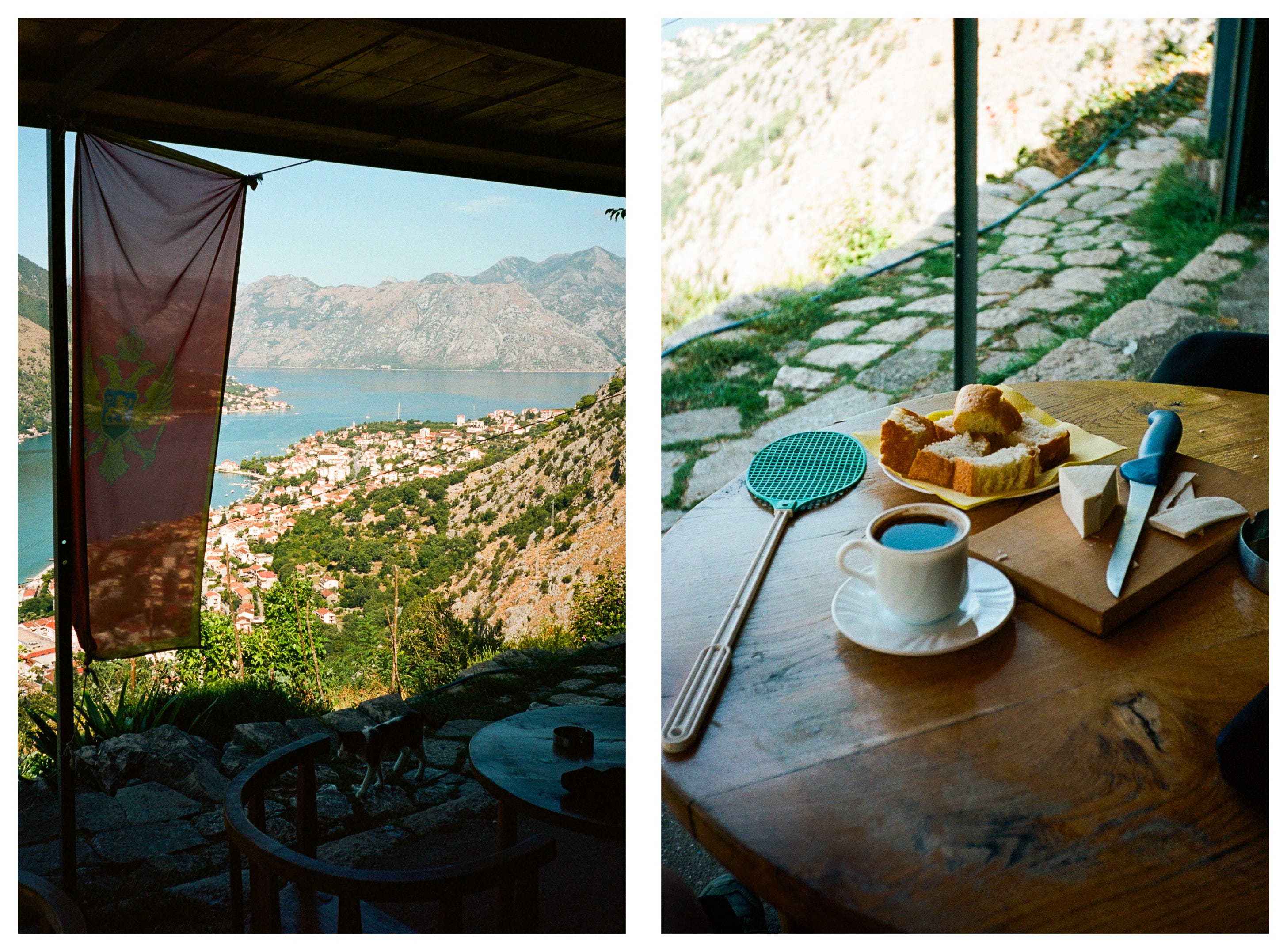
The bottom of this trail and its switchbacks are well-known and visible from the town. A lot of visitors hike this section and climb to the cheese shop just above the 200 meters mark for refreshments before heading back down. It is as nice as it sounds. (As in cosy, not fancy.)
But there was something in me that wanted to reach the views that most others would not. I wanted to climb higher, and I would bring my cameras1 along too. I could both sample the cosiness of the cheese shop and make some errors in judgment and preparation that would later drench my shirt.
I would also make these photos, of course.
The climb
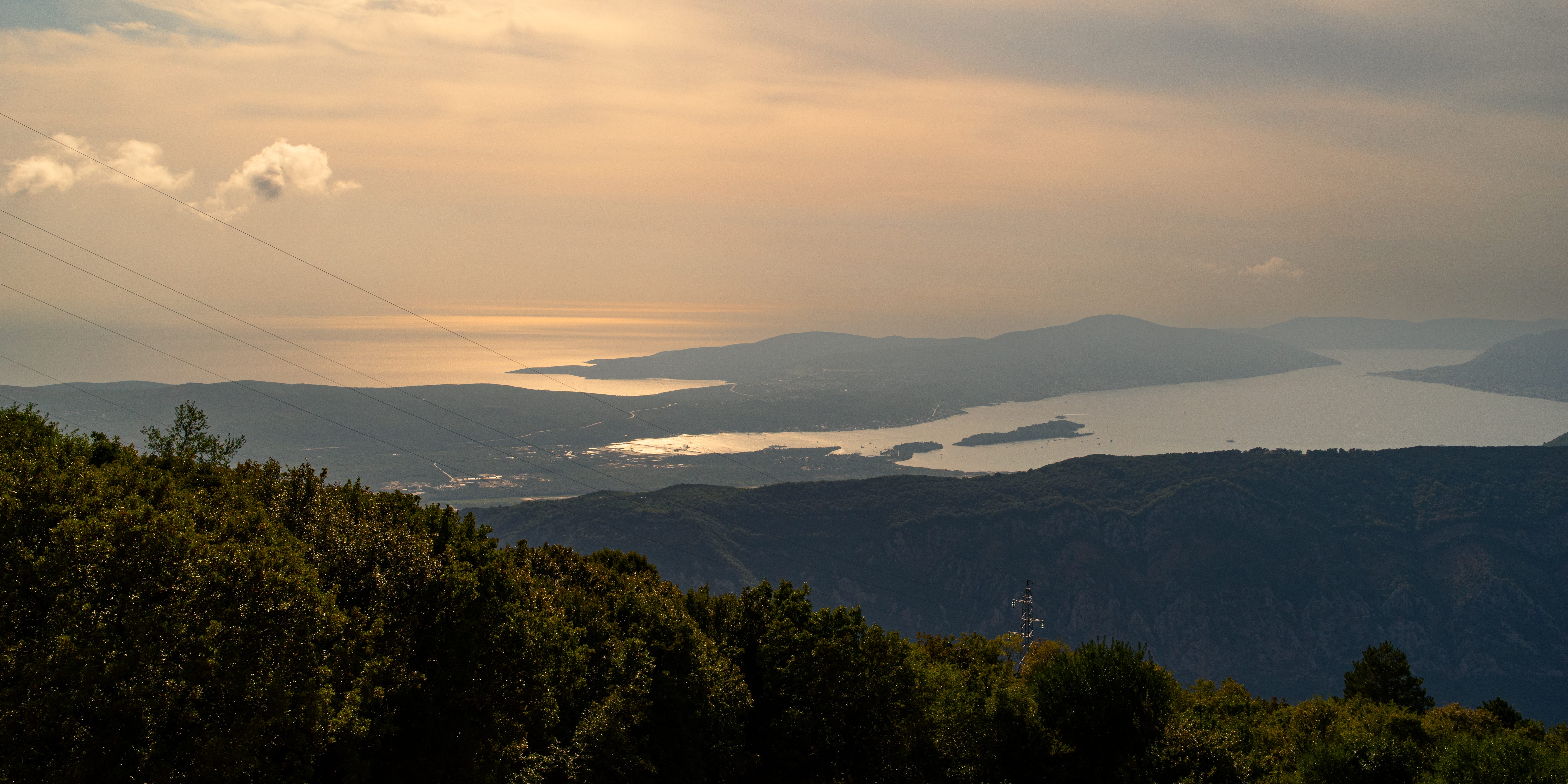
Every hundred meters of elevation served us seemingly another version of the bay and valley below. The natural landscape of mountains covered in yellow-orange grasses and green trees felt like a new scene at each and every stop. Waterfront settlements that once ran together became dotted groupings of white and orange.
I remarked out loud that I have never been so close and so far from civilisation at the same time.
As we climbed, switchback after switchback, the town and the bay continued to shrink below us. Relative shade from the 30 degrees of midday sun became more seldom along the way.
This is not the summit
Eventually, we reached what was marked as the top of the trail.
It was here that I discovered my mistake.
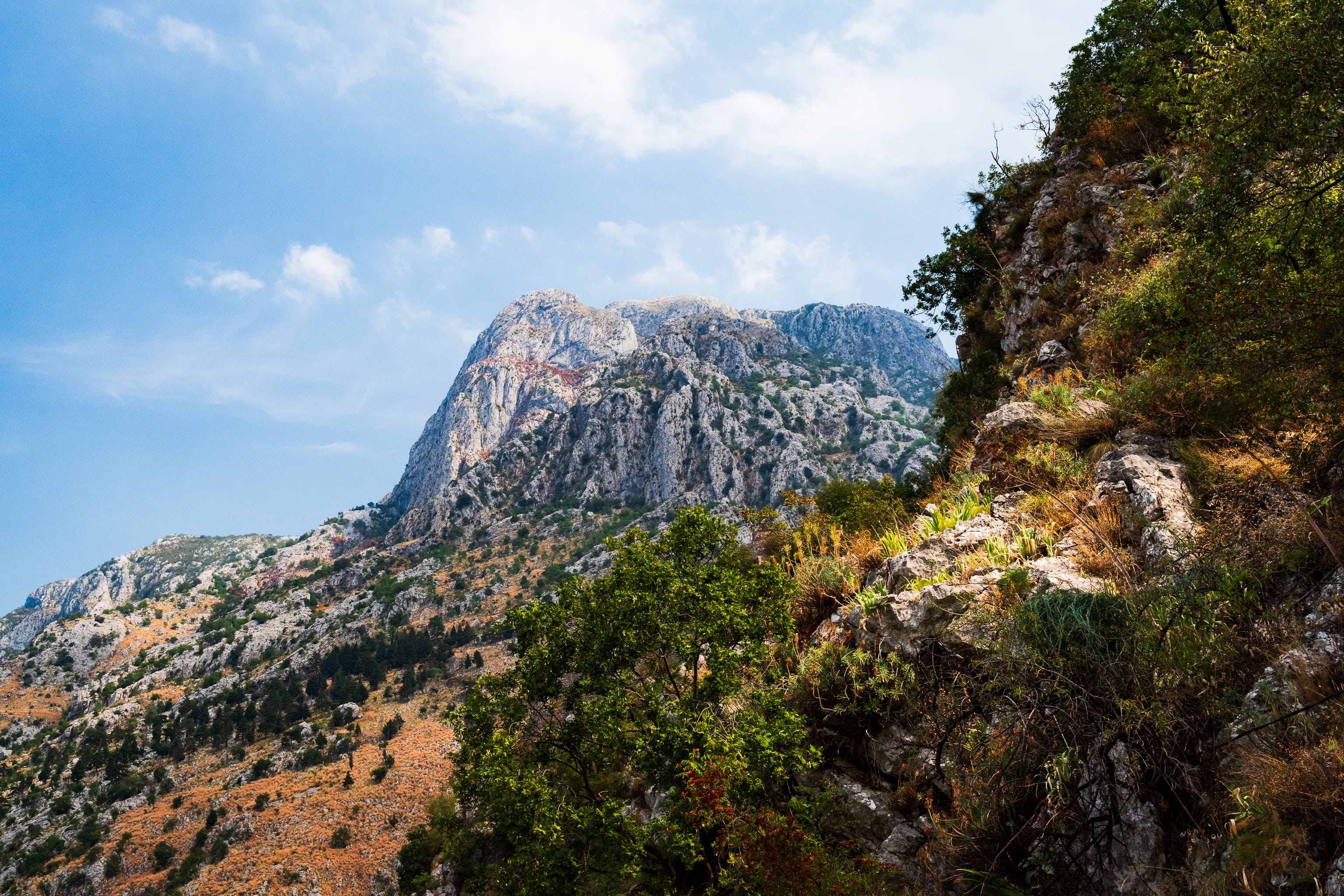
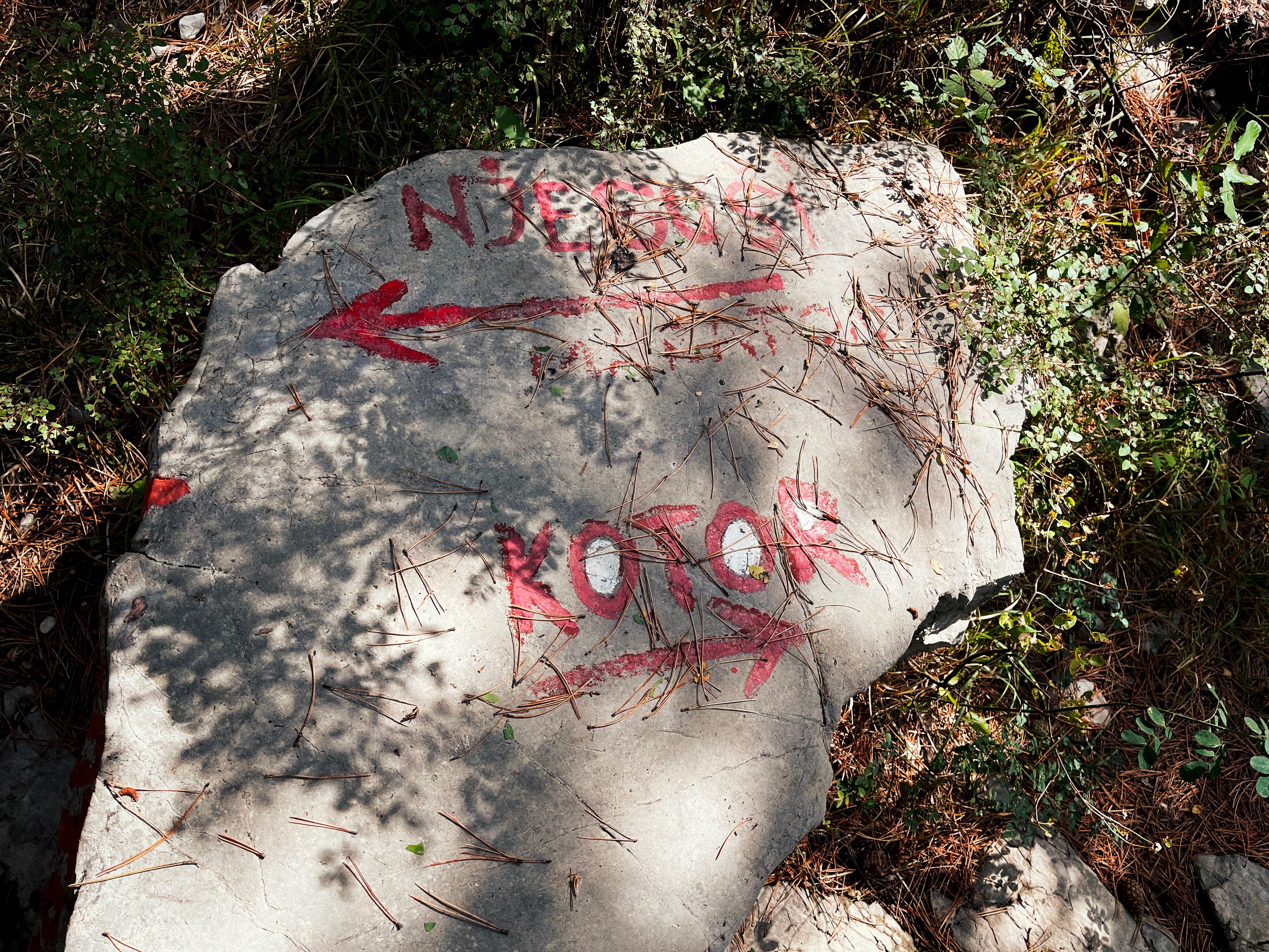
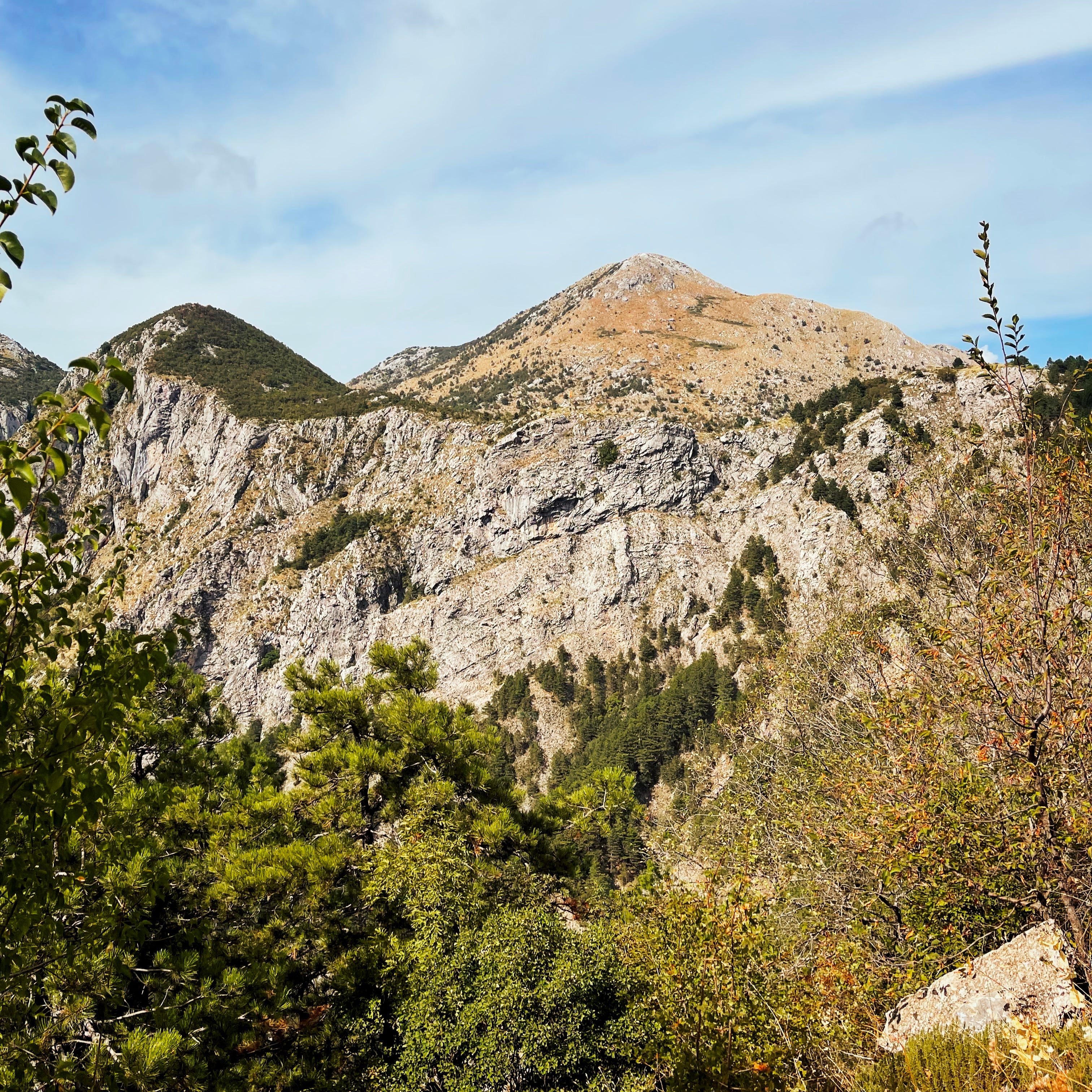
That I should have consulted a proper topographic map2 — the switchbacks would soon end. The trail led inside of a forest and would drag us upwards another 400 meters of elevation. Elevation that needed to be traversed by paths going straight uphill at difficult grades.
The beautiful sweeping views of mountains, valley and water would be largely lost to the leaves of the forest.
As we worked our way through, we encountered difficulties on the way. Pathfinding blazes became less prominent, and an important fork in the trail was left unmarked. Determining the way forward began to take priority over picture making, and a wrong turn forced us to backtrack. This cost us a lot of time and remaining energy.
The final stretch was strenuous and challenging.
I could feel every ounce of the weight of the cameras on my back. Our water was running low. I ate our last protein bar probably 200 horizontal meters from the finish and mused if this was how it would end for me.
Sounds of life
We pushed forward a final time, and the path broke out of the trees into the open sun.
I heard voices and music. The tyres of cars crunched on gravel not far away.
A short distance further and a few stone steps up, I was stood on a road not far along from a cliff-side restaurant.
Looking out, I saw the landscape was covered in the blue haze of the afternoon. In the distance, I could see the Adriatic Sea and the light of our distant sun reflecting blindingly off of the water. We were at the top.
I had done what I set out to do.
Technical note on cameras: Pentax K-1 Mark II full frame digital; Pentax 17 half-frame film (Portra 160)
I do not recommend relying on Google Maps for this.
it's already on my to visit list.